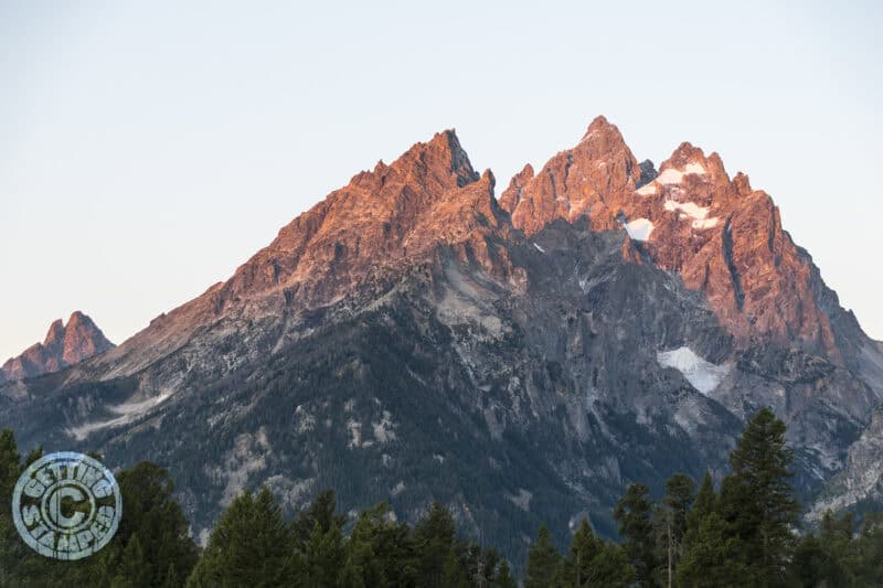
Heading to the Grand Tetons and hoping to hit the trails hiking? That is exactly what we just did on our #epicUSroadtrip. There are many reasons to hit the trails, one of the biggest is the number of tourists drastically decreases when it requires hiking.
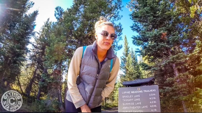
We hiked the 4.8-mile hike to the Amphitheater, which took us 6 hours round trip including stopping for amazing photo ops & to catch our breath. Planning on taking a similar hike in the Grand Tetons, here are 7 tips for hiking in the Grand Tetons.
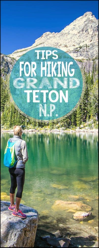
Hiking In The Grand Tetons National Park
Start The Hike Early
The earlier you start your hike the better, for several reasons. The earlier, the less tourist you’ll encounter on the trails. The sooner you hit the trails the more time you will have to stay out on the trail before you have to head back before dark.
The earlier you start the cooler the temps are, which may be a plus or minus to you. I know we hit the trails at 8:30 a.m. and I was chilled at first but within 10 minutes I was warmed and feeling great.
Don’t Trust the Park Map
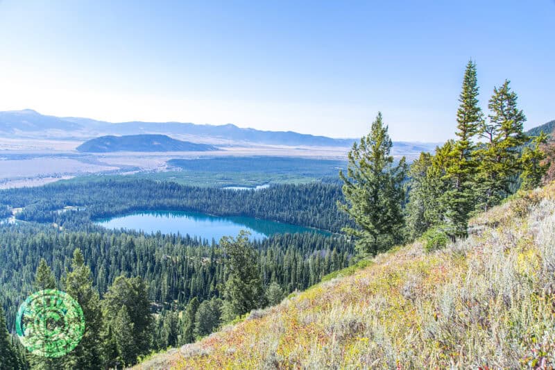
The park map that the rangers give you at the park entrance is fine for driving but not ideal for hiking. The map covers too large of an area to give you the true scale or details of the hike.
For example, on the hike to the Amphitheater lake on the park map shows only 3 switchbacks, when in reality there are at least 50.
Bring A Snack & Pack Lunch
After hiking for miles, your body will be craving some energy. I suggest packing more than you think, you may end of having a snack halfway up and then enjoying lunch at your destination and then having another snack half way down.
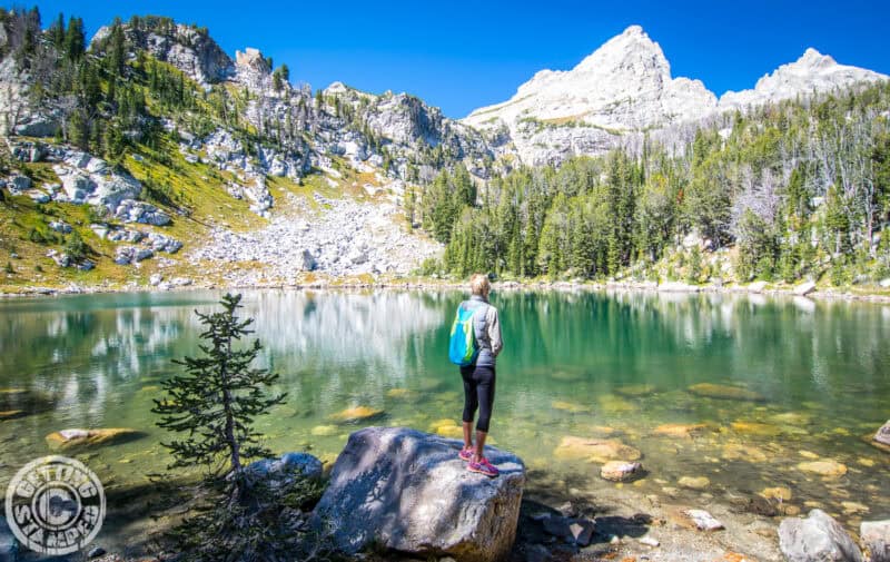
That is exactly what happened to us. We packed apples, peanut butter sandwiches, and some pretzels. We were the only people at Surprise Lake for our lunch stop, I couldn’t have asked for a better place to sit and take in the Grand Tetons.
Bring Bear Spray
No, I am serious! Bears are real and they really in the Grand Tetons. Better be safe than sorry, carry bear spray. You’ll see signs all over the Grand Tetons telling you to “Be Bear Aware” and to carry bear spray.
The Park Service also recommends attaching bells or other noisemakers to make sure you don’t startle a bear as you hike the Grand Tetons.
1 Liter+ Of Water Per Person
Depending on the length of your hike will determine how much water you should bring. On our 10 mile hike, we each brought 1 liter, all of which we consumed before getting back to the car.
You have to remember you are at 6,500 feet above sea level at the start of the hike, and the elevation increases to as high as 10,000+ feet on many hikes in the Grand Tetons.
Don’t Hike Alone
Hiking with someone is safer for many reasons! If you can don’t hike alone, but if you must make sure to bring enough water and supplies you’ll need, it’s also a good idea to sign the trail log (where available).
You’ll probably pass other hikers along the trail and you should be fine hiking in the Grand Tetons is the main attraction. Stay alert and be aware of your surroundings.
Wear Layers of Clothes
You might be hitting the trails when it’s 30°F (0°C) if you leave in the morning. We visited the first week of September and the temps were in the 30’s most mornings. Once you start moving and the sun comes up you’ll warm up fast, in the summer months expect temperatures in the 70-90’s.
On our hike, I took off almost all of our layers as we were heading up. However, when we reached our destination that was 9,000+ feet, I was throwing my sweatshirt back on because it was chilly.
Bring Your Camera
The views you will find along the hiking trail and at your final destination will be one you will want to capture. Make sure to pack your camera, double check your battery life & make sure your memory card is ready to make some memories. The Grand Tetons are very photogenic if you ask me…
Now go lace up your hiking shoes and hit the hiking trails in the Grand Tetons. Happy Hiking!
Like This Article? Pin Me For Later
Comments
Post a Comment